Day mileage: 378.3
States: Michigan
Highlights: GC36, Lake Michigan, Mackinac Bridge
Noteworthy food stops: Biere de Mac Brew Works
Overnight: Michigan State Forest dispersed camping
This post is Day 2 of our summer road trip. For more, visit our trip overview post.
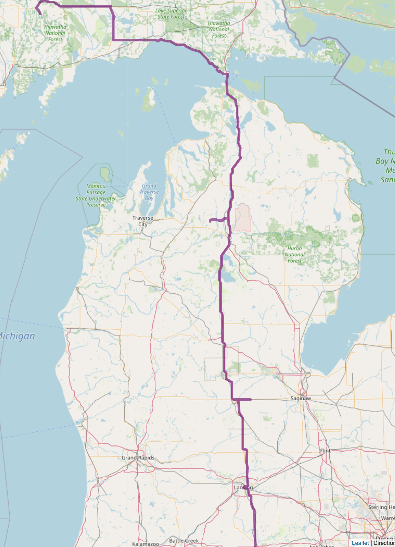
The Route
Having made the decision to visit the UP, today was about positioning ourselves for a visit to Pictured Rocks National Lakeshore tomorrow. It was also an opportunity to break in the new rooftop tent, which meant we would need to find a place to camp.
Looking at the straight-line route, the obvious detours would include a stop in Lansing (to visit a state capital) and Mackinaw City for dinner. State forests and Hiawatha National Forest would offer dispersed camping options.
From a geocaching perspective, must-dos included Geocache 612 (GC36) and Middle of the Mitten Webcam (GCH48P).
About Our Day
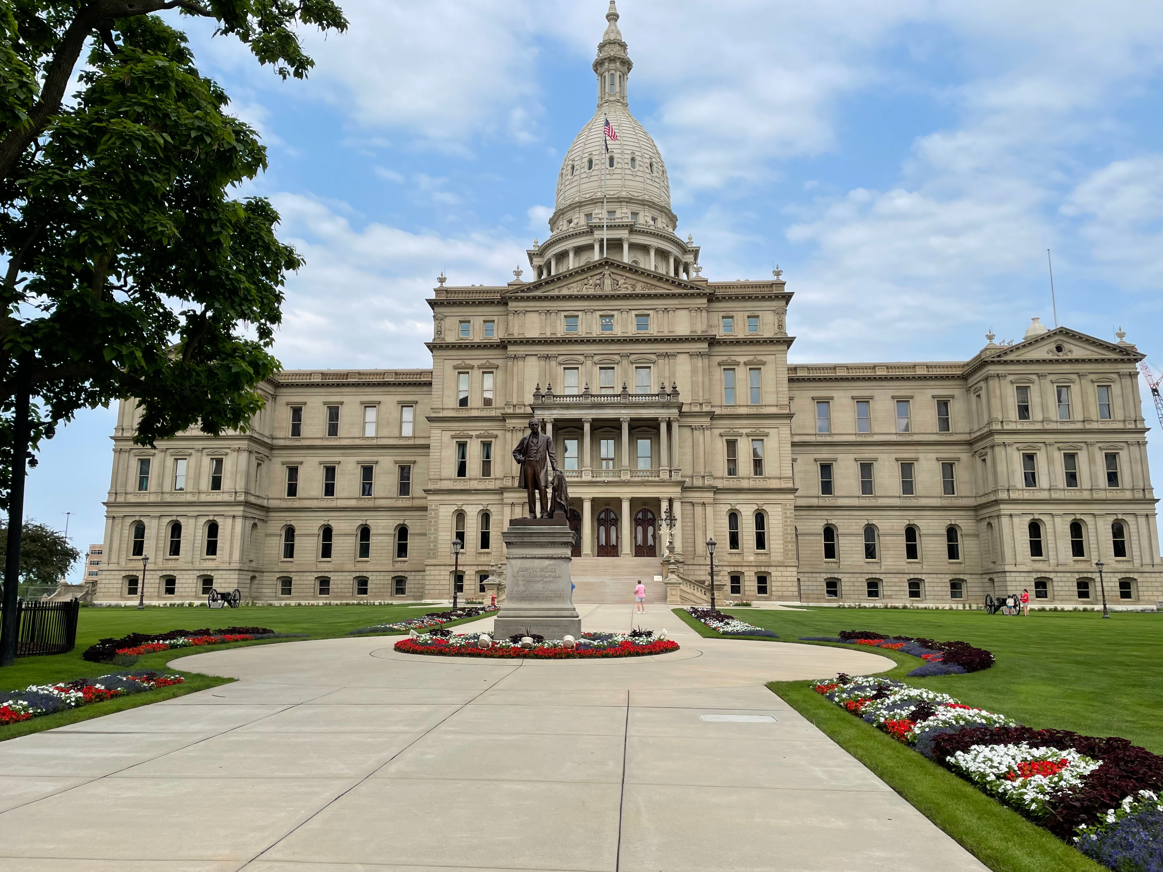
First stop of the day: Michigan’s State Capitol, Lansing. Downtown was deserted, and there was a good amount of construction and some road closures around the capitol building. We found nearby parking and attempted to go to a local coffee shop. Unfortunately, it was closed for the holiday weekend.
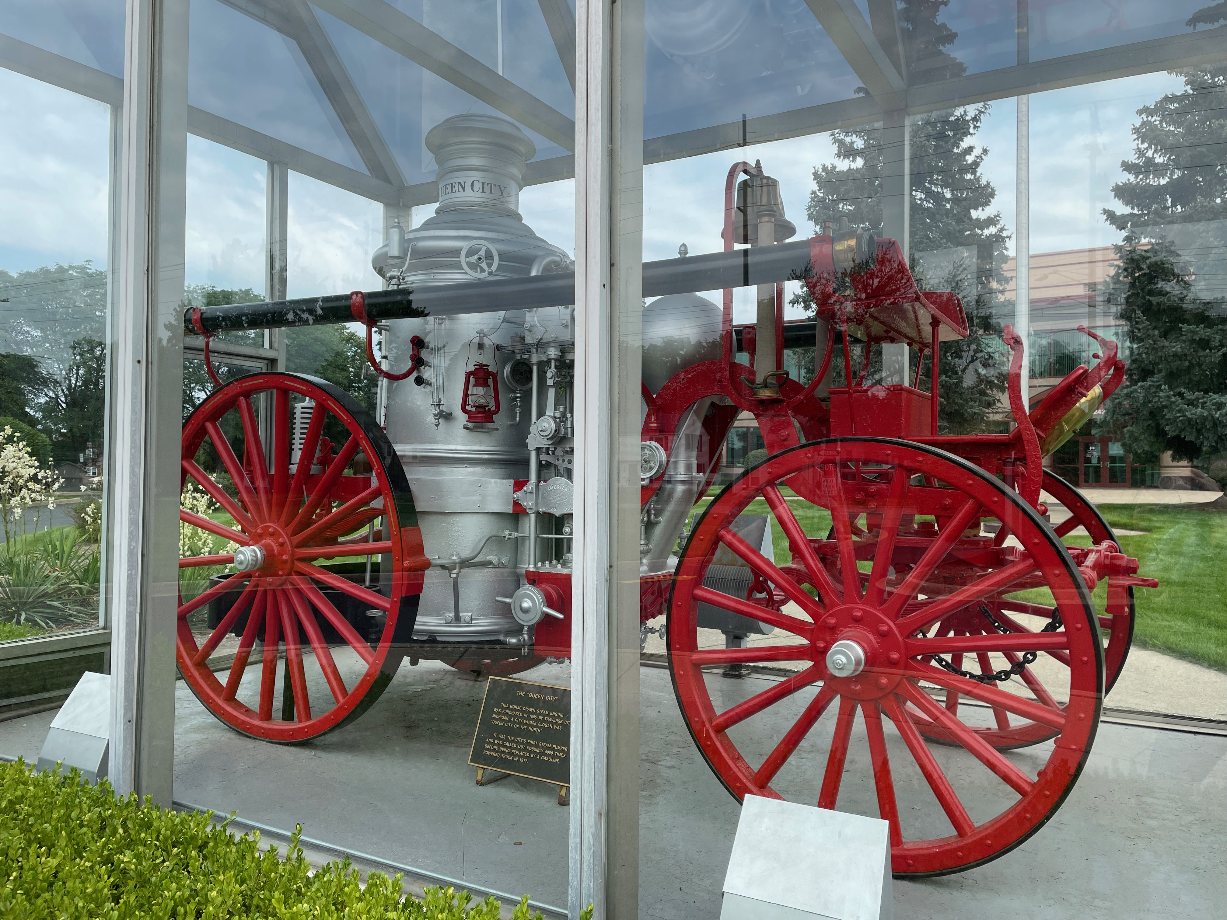
We used virtual geocaches to take us on a quick tour of the area surrounding the Capitol on our way out of town. Stops included a few hidden murals, an old train station (the former Clara’s Lansing Station), and The Queen City (steam pumper fire engine).
Middle of the Mitten
From Lansing, it was just about driving north with the occasional stop to stretch legs, use the restroom, or grab a geocache at a rest area. When first planning the trip, I was excited to see a webcam right along our route. No brainer – definitely add a stop there. Later, I realized that it was not at the posted coordinates, and it would be a 40 minute-ish detour to get. But, as it is a webcam, we kept it on the list. Now, back in April/May, when I first did my research, everything was fine with the cache. By the time we arrived at GZ and decided to pull up the page … uh oh … the image is white. Camera is down. 🤦♀️
We snapped some photos given we did drive all the way there and then headed back to the highway, extremely disappointed. The sign for a Tim Horton’s perked us up though, and we swung through the drive-thru for some Timbits before heading on our way.

Geocache 612
The next big, planned stop was hours later in Kalkaska County. One of four remaining geocaches from August 2000 still in play. We did our diligence and knew that coming from the south, as the GPS would typically route you, was not ideal due to the distance to travel on seasonal roads. Instead, we exited near Frederic and headed west along County Rd 612 NE, which is paved. Turning south on Blue Lake Road NE, we encountered a hard-packed dirt road. Phew. Given the dry weather, the road was easily navigable. We opted to park along the side of the road and walk the rest of the distance to the cache to avoid the loose sand and the two-track road. Admittedly the walk was a bit further than I expected from the planning stage, but it was largely straight forward, and we ended with a smiley.
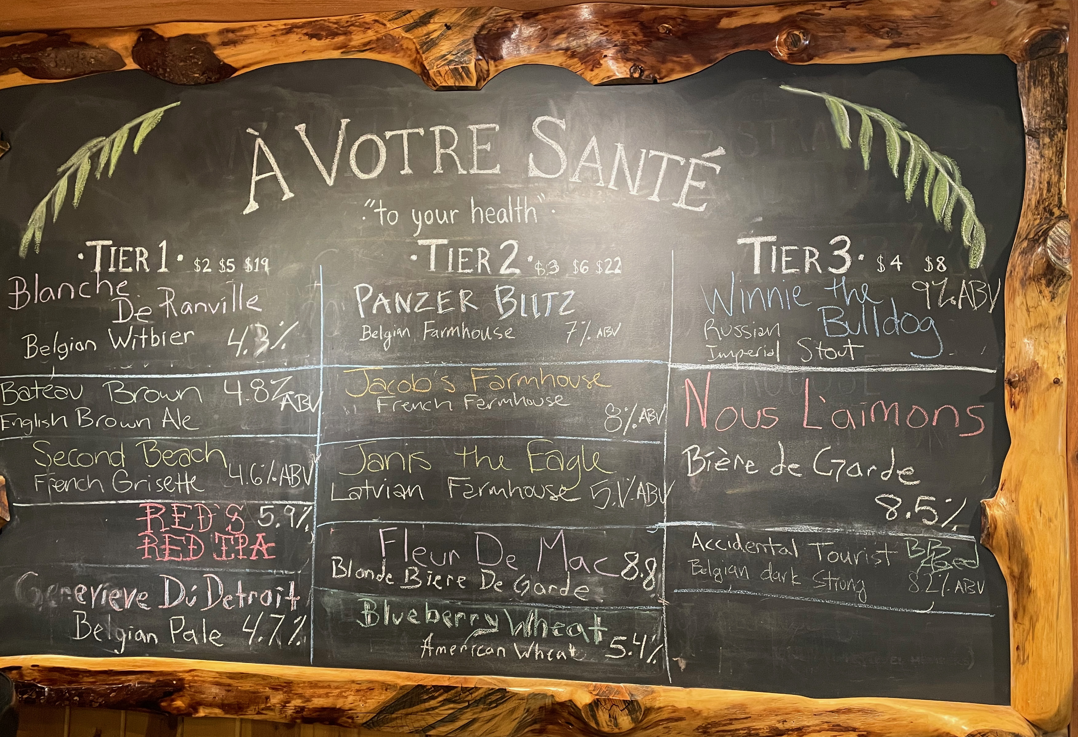
Biere de Mac Brew Works
Nearly to Mackinaw City, we knew it would be better to get dinner before heading to the U.P. What better than to stop at a local brewery that would have food trucks? An easy drive from 75, we made our way to Biere de Mac Brew Works, which has plenty of parking and both indoor and outdoor seating. After heading inside to order our beers, we went out into the garden to order from the food trucks (Flat Top Burgers and The Dig’s) and enjoy the beautiful weather.
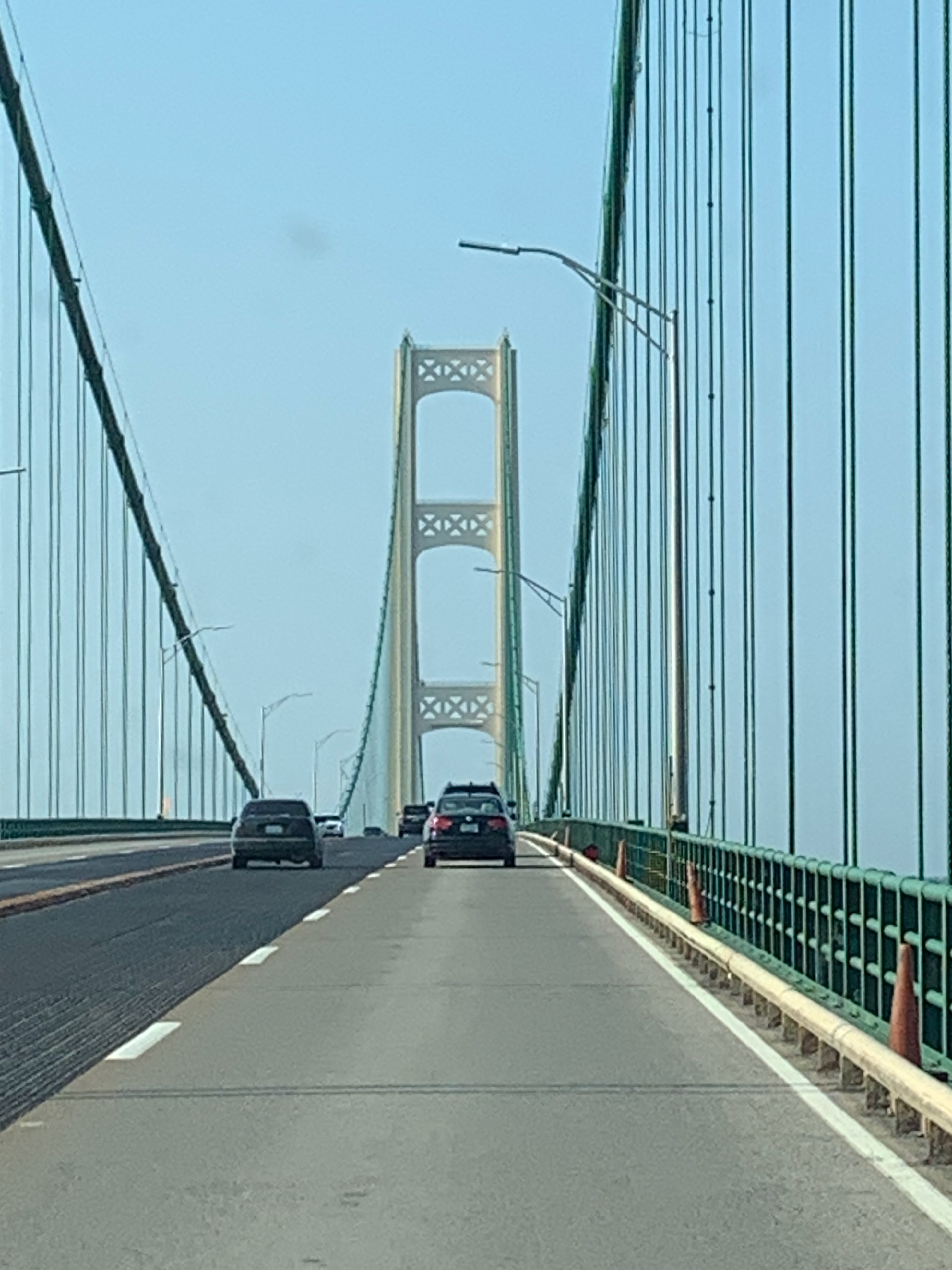
Crossing the Mackinac
It was finally time to cross the Mackinac Bridge into the U.P. Despite the holiday weekend, the bridge traffic appeared to be fairly light, and there was only a slight delay at the toll plaza once we reached the opposite side. Fortunately, the weather was good, and there was no wind, which made the drive easy.
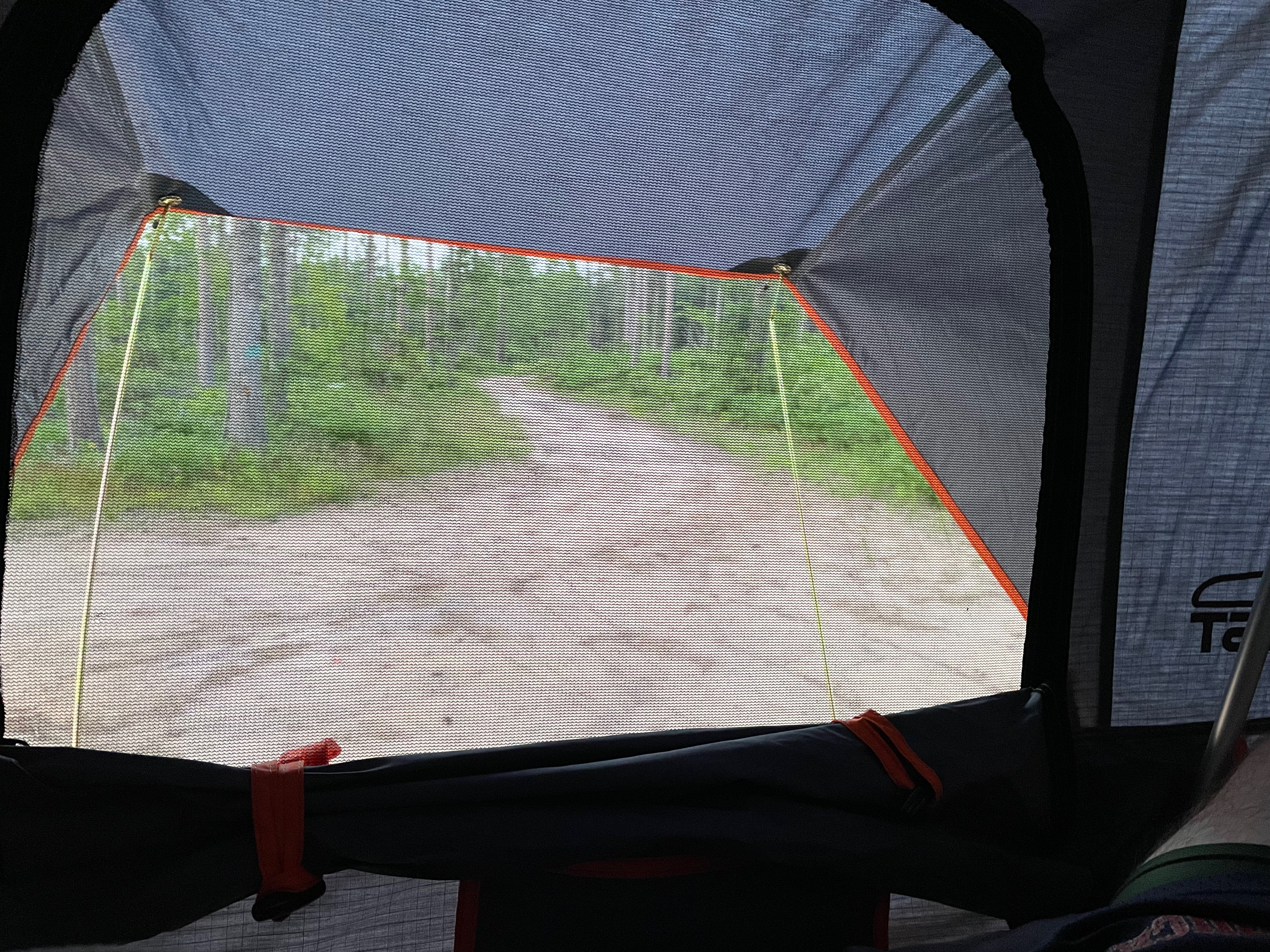
Finding our campsite
The rest of the evening was spent driving along US-2 and Lake Michigan to M-77. We occasionally stopped to enjoy the lake views but mostly kept moving in the hopes of being able to scope out a campsite before sunset. We had identified a couple of state forest roads where we could camp as well as some in the National Forest as well. Given the holiday weekend, we kept our fingers crossed that we would be able to find a spot.
As expected, the first location was not ideal – the road was barely more than a two-track, so we kept going. The second location had a much better looking road (despite it being sand), so we gave it a shot. No sooner had we thought it could work did we notice the swarm of black flies following the car. Eventually, we made it to the pull off area that would allow us to not block the road. Maybe it would work after all?
We stayed, but it was not a good night. The black flies were awful, making the even brief time outside the car very challenging. Thank goodness we brought head nets with us. We also brought a very large mosquito net that we put over the open trunk hatch while we prepared for the evening. It ended up being a little too large to be manageable, but it was necessary for the evening. We quickly clamored up into the tent for the night, glad to have escaped the black flies. Unfortunately, the mosquitoes found us and made for a sleepless night (either they came into the tent with us when we first got in or we failed to close something, and they found the opening).

Leave a comment